Where's My Brumby Now: Chris Pollitt Offers Donors a Chance to Ride Along for Hoof Research...by Satellite!

Australian Hoof Research Project Brief:
Determining the range of the Australian wild
horse (Brumby) and the relationship to foot
type and conformation.
Our team has spent much of the past 12
months investigating the use of GPS
technology to track the movements of horses.
As a result we have developed the ideal tool
to track the day-to-day movements of horses
in both the domestic and wild environments.
Our GPS tracking units allow us to
accurately pinpoint the location, speed and
altitude of the horse at one-second
intervals for up to one week or at 30-second
intervals for up to six months.

This exciting technology is being applied to horses for the first time by our research team, with the goal of establishing a complete picture of the movements of horses, both domestic and wild, and how they interact with their environment.
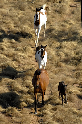
The effect of movement and environment on the horse’s foot is a significant focus of the research. We know from preliminary work that the typical domestic horse’s foot travels very little (approximately 7 km daily) in comparison to its wild counterpart which may travel up to 50 km or more in a single walk. We have several populations of "Brumbies" (Australian feral horses) under investigation to determine natural foot structure and function under various environmental conditions.

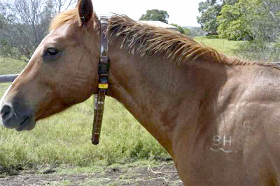
We are about to embark on the most exciting part of the research: to track the wild horses. Brumbies will be darted silently from a hide with a tranquilizer, giving the team two minutes to photograph feet, place permanent markers to determine hoof wall growth rates and attach the GPS collar (see photo).
On reversal of the tranquilizer, the horse will rejoin its family band unaware of the intervention. The same horse will be recaptured using the dart gun at the end of the trial to retrieve equipment and then released back to the wild.
This work will begin in March 2008 and continue for 12 months in locations in Central and Northern Queensland and the Northern Territory and Eastern Kimberly region of Western Australia. The project will ultimately identify the relationship between a horse’s movement and the effect on foot conformation, structure and function.
Our goal is to make well-informed recommendations of the ideal conditions to keep domestic horses to improve the well-being of their feet.
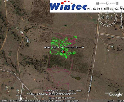
You can help in this groundbreaking research. The more GPS units we can attach to wild horses, the better and more accurate the data set will be. For AUS$3000 (approx $2,600 US) you can own and name a wild horse for the 4 to 6 month tracking season. We will supply photos and location data at the time of GPS attachment and, when retrieved, we will use the GPS download from your horse to generate a report using Google Earth maps.
Ultimately, the combined data from all the horses will be compiled into freely available scientific reports.
Please help if you can.
Professor Chris Pollitt
Professor of Equine Medicine
School of Veterinary Science
The University of Queensland
St Lucia, Brisbane, Queensland AUSTRALIA
email c.pollitt@uq.edu.au
website: www.laminitisresearch.org
fax 07 3365 2351